
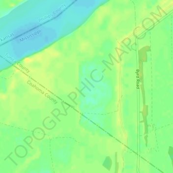
Eagle Lake topographic map
Interactive map
Click on the map to display elevation.
About this map
Name: Eagle Lake topographic map, elevation, terrain.
Location: Eagle Lake, Tunica County, Mississippi, United States (34.52005 -90.54960 34.52015 -90.54950)
Average elevation: 177 ft
Minimum elevation: 141 ft
Maximum elevation: 207 ft
Mississippi trails, hiking, mountain biking, running and outdoor activities
Other topographic maps
Click on a map to view its topography, its elevation and its terrain.
Diamondhead
United States > Mississippi > Hancock County
Much of the land that became Diamondhead had been purchased by Walter Gex, Sr., in 1937 from the Gulf State Paper Company and the Easy Opener Bag Company. Additional land was purchased by Gex, bringing his acquisition to nearly 5,000 acres (2,000 ha). In the late 1960s, D.E.A.R., Inc., later known as the…
Average elevation: 10 ft
Lake Catherine
United States > Mississippi > Hinds County > Jackson > Lost Lake
Average elevation: 328 ft
Bay of Saint Louis
United States > Mississippi > Harrison County > Pass Christian
Average elevation: 13 ft
Bell-Sandifer Leisure Park
United States > Mississippi > Forrest County > Hattiesburg
Average elevation: 161 ft
Latimer
United States > Mississippi > Jackson County > Martins Pine Hill Estates
Average elevation: 39 ft
Marine Education Center
United States > Mississippi > Jackson County > Ocean Springs
Average elevation: 13 ft
Buccaneer State Park
United States > Mississippi > Hancock County > Waveland > Gulfside
Average elevation: 13 ft
Grand Bay Natural Wildlife Refuge
United States > Mississippi > Jackson County > Moss Point
Average elevation: 10 ft