Geolocate

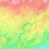
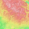
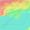
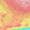
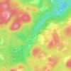
Cochrane District topographic map

Click on the map to display elevation.

About this map

Name: Cochrane District topographic map, elevation, terrain.

Location: Cochrane District, Northeastern Ontario, Ontario, Canada (48.27573 -86.54943 52.29382 -79.51642)

Average elevation: 607 ft

Minimum elevation: -7 ft

Maximum elevation: 1,936 ft

Other topographic maps

Click on a map to view its topography, its elevation and its terrain.
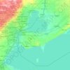
Toronto

Canada > Ontario > Toronto

Despite its deep ravines, Toronto is not remarkably hilly, but its elevation does increase steadily away from the lake. Elevation differences range from 76.5 metres (251 ft) above sea level at the Lake Ontario shore to 209 m (686 ft) ASL near the York University grounds in the city's north end at the…

Average elevation: 371 ft
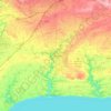
London

Canada > Ontario > London > London

London has a humid continental climate (Köppen Dfb), though due to its downwind location relative to Lake Huron and elevation changes across the city, it is virtually on the Dfa/Dfb (hot summer) boundary favouring the former climate zone to the southwest of the confluence of the South and North Thames Rivers,…

Average elevation: 879 ft
Hamilton

Canada > Ontario > Hamilton

Average elevation: 594 ft

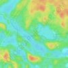
Muskoka River

Canada > Ontario > Muskoka District > Bracebridge

Average elevation: 807 ft

Niagara Escarpment

Canada > Ontario

Average elevation: 981 ft

Parry Sound

Canada > Ontario

Average elevation: 771 ft

Kingston

Canada > Ontario > Kingston

Average elevation: 308 ft

Guelph

Canada > Ontario > Guelph

This region of Ontario has cold winters and warm, humid summers, falling into the Köppen climate classification Dfb zone, with moderately high rainfall and snowfall. It is generally a couple of degrees cooler than lower elevation regions on the Great Lakes shorelines, especially so in winter, the exception…

Average elevation: 1,129 ft
Peterborough

Canada > Ontario > Peterborough

Peterborough's topography is largely defined by land formations created by the receding Wisconsian glaciers 10,000–15,000 years ago. The South End and Downtown portions of the City sit on what was the bottom of the glacial Lake Peterborough—part of a glacial spillway created when glacial meltwaters from…

Average elevation: 771 ft
High Park

Canada > Ontario > Toronto

Average elevation: 318 ft

Ottawa

Canada > Ontario > Ottawa > Ottawa

Average elevation: 325 ft

Hamilton Mountain

Canada > Ontario > Hamilton

Average elevation: 538 ft

Oak Ridges

Canada > Ontario > Simcoe County > Adjala–Tosorontio

Average elevation: 883 ft

Waterford

Canada > Ontario > Norfolk County > Waterford

Average elevation: 791 ft

Ishpatina Ridge

Canada > Ontario > Sudbury District > Unorganized North Sudbury

Ishpatina Ridge is the highest point of land in the Canadian province of Ontario, at an estimated 693 m (2,274 ft) above sea level. Ishpatina Ridge rises approximately 300 m (984 ft) above the immediate area. It was only truly recognized as Ontario's highest point after topographical mapping by the Government…

Average elevation: 1,788 ft

Kenora

Canada > Ontario

Average elevation: 597 ft

Belleville

Canada > Ontario > Belleville

Average elevation: 351 ft

Brantford

Canada > Ontario > Brantford

Average elevation: 781 ft

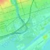
Windsor

Canada > Ontario > Windsor

Average elevation: 607 ft

Perth

Canada > Ontario

Average elevation: 1,027 ft

Niagara Escarpment

Canada > Ontario > Burlington

Average elevation: 709 ft

Bognor

Canada > Ontario > Grey County > Meaford

Average elevation: 873 ft

Haliburton

Canada > Ontario

Average elevation: 1,175 ft

Christie Pits Park

Canada > Ontario > Old Toronto

Average elevation: 384 ft

Wiarton

Canada > Ontario > Bruce County

Average elevation: 673 ft

Dundas

Canada > Ontario > Hamilton > Dundas

Dundas /ˈdʌnˌdæs/ is a community and former town in Hamilton, Ontario, Canada. It is nicknamed the Valley Town because of its topographical location at the bottom of the Niagara Escarpment on the western edge of Lake Ontario. The population has been stable for decades at about twenty thousand, largely…

Average elevation: 561 ft

Oak Ridges

Canada > Ontario > Unorganized North Sudbury

Average elevation: 886 ft

Woodstock

Canada > Ontario > Woodstock

Average elevation: 1,004 ft

Niagara Escarpment

Canada > Ontario > Hamilton

Average elevation: 531 ft

Centennial Park

Canada > Ontario > Toronto

Average elevation: 495 ft

Long Point

Canada > Ontario > Norfolk County

Average elevation: 568 ft

Oak Ridges

Canada > Ontario > Simcoe County > Adjala–Tosorontio

Average elevation: 899 ft

Prince Edward

Canada > Ontario

Average elevation: 387 ft

Lambton

Canada > Ontario

Average elevation: 617 ft

Essex

Canada > Ontario

Average elevation: 633 ft

St. Thomas

Canada > Ontario > St. Thomas

Average elevation: 758 ft

Lac Seul

Canada > Ontario

Average elevation: 1,198 ft

Frontenac Provincial Park

Canada > Ontario > South Frontenac

Frontenac Provincial Park is located near the town of Sydenham, north of the city of Kingston, Ontario, Canada. The Government of Ontario has classified Frontenac Provincial Park as a natural environment park. The park lies on the Frontenac Axis, a topographic extension of the Canadian Shield, which connects…

Average elevation: 495 ft

Harlem Shoal

Canada > Ontario

Average elevation: 574 ft

St. Johns

Canada > Ontario

Average elevation: 673 ft

Blue Mountain

Canada > Ontario > Timiskaming District > Kirkland Lake

Average elevation: 1,135 ft

Don River

Canada > Ontario > Toronto

Average elevation: 262 ft

Quetico Provincial Park

Canada > Ontario

Average elevation: 1,417 ft

Ohsweken

Canada > Ontario

Average elevation: 682 ft

Pinehurst Lake

Canada > Ontario

Average elevation: 968 ft

Docker Lake

Canada > Ontario

Average elevation: 1,237 ft

Oneida Nation of the Thames

Canada > Ontario

Average elevation: 735 ft

Bigwin Island

Canada > Ontario

Average elevation: 1,076 ft

Upper Pergeon Lake

Canada > Ontario

Average elevation: 705 ft

York River

Canada > Ontario

Average elevation: 1,302 ft

Kawartha Lakes (city)

Canada > Ontario

Average elevation: 899 ft

Pelee Island

Canada > Ontario

Average elevation: 568 ft

Quinte West (city)

Canada > Ontario

Average elevation: 525 ft

Cayuga

Canada > Ontario > Haldimand County

Average elevation: 643 ft

London

Canada > Ontario

London has a humid continental climate (Köppen Dfb), though due to its downwind location relative to Lake Huron and elevation changes across the city, it is virtually on the Dfa/Dfb (hot summer) boundary favouring the former climate zone to the southwest of the confluence of the South and North Thames Rivers,…

Average elevation: 883 ft

Lambton

Canada > Ontario

Average elevation: 627 ft

Algoma District

Canada > Ontario

Average elevation: 1,181 ft

London (city)

Canada > Ontario

Average elevation: 784 ft

Kagawong

Canada > Ontario > Manitoulin District > Billings Township

Average elevation: 676 ft

Harcourt

Canada > Ontario > Haliburton County

Average elevation: 1,355 ft

Cambridge

Canada > Ontario > Cambridge

Average elevation: 968 ft

Stratford

Canada > Ontario > Stratford

Average elevation: 1,168 ft

Naskapi Ridge Park

Canada > Ontario > Ottawa

Average elevation: 233 ft

Fanshawe Lake

Canada > Ontario > Middlesex County > Thames Centre

Average elevation: 896 ft

Temagami

Canada > Ontario > Nipissing District

Average elevation: 978 ft

Nettie Lake

Canada > Ontario > Timiskaming District > Kirkland Lake

Average elevation: 1,152 ft

Marmora

Canada > Ontario > Hastings County > Marmora and Lake

Average elevation: 656 ft

Fergus

Canada > Ontario > Wellington County > Centre Wellington

Average elevation: 1,362 ft

Bruce Peninsula

Canada > Ontario > Grey County > Georgian Bluffs

Average elevation: 787 ft

Rouge National Urban Park

Canada > Ontario > Toronto

Average elevation: 469 ft

Downsview Park

Canada > Ontario > Toronto

Average elevation: 610 ft

Wheatley

Canada > Ontario > Chatham-Kent

Average elevation: 594 ft

Chandos Lake

Canada > Ontario > Peterborough County > North Kawartha

Average elevation: 1,053 ft

Scarborough Bluffs

Canada > Ontario > Toronto

Average elevation: 394 ft

Edgar

Canada > Ontario > Simcoe County > Oro-Medonte

Average elevation: 1,079 ft

Trenton

Canada > Ontario > Quinte West

Average elevation: 292 ft

McCaul-Orde Park

Canada > Ontario > Toronto

Average elevation: 348 ft

Almonte

Canada > Ontario > Lanark County > Mississippi Mills

Average elevation: 449 ft

The Arboretum

Canada > Ontario > Guelph

Victoria Woods is an old-growth hardwood forest made up of sugar maple, white ash, black cherry and beech. Varied topography in this area, which includes a pond, allows for a wide variety of woodland plants to grow here. Spring is an especially nice time to visit Victoria Woods to see many of these spring…

Average elevation: 1,089 ft
Gloucester Pool

Canada > Ontario > Georgian Bay Township

Average elevation: 610 ft

Combermere

Canada > Ontario > Renfrew County > Madawaska Valley

Average elevation: 1,043 ft

Loon Lake

Canada > Ontario > Kearney

Average elevation: 1,309 ft

Midhurst

Canada > Ontario > Simcoe County > Springwater

Average elevation: 837 ft

Arden

Canada > Ontario > Frontenac County > Central Frontenac

Average elevation: 656 ft

Muskrat Lake

Canada > Ontario > Renfrew County > Cobden

Average elevation: 479 ft

Kohler

Canada > Ontario > Haldimand County > Kohler

Average elevation: 666 ft

Parry Sound

Canada > Ontario > Parry Sound District > Parry Sound

Average elevation: 663 ft

Wimbleton Road South Parkette

Canada > Ontario > Toronto

Average elevation: 430 ft

Brigden

Canada > Ontario > Lambton County > St. Clair

Average elevation: 627 ft

Wilno

Canada > Ontario > Renfrew County > Madawaska Valley

Average elevation: 1,089 ft

Gear up for your next adventure:

📡Handheld GPS Device - Reliable handheld GPS for outdoor navigation
🛶Inflatable Kayak - Portable kayak for rivers, lakes, and expeditions
🛠️Outdoor Gear Repair Kit - Essential tools to fix gear on the trail
🛰️Handheld GPS Units - Professional satellite navigators for precise backcountry mapping
📻Weather Alert Radios - Stay informed of storm risks while off-the-grid

As an Amazon Associate, this site earns from qualifying purchases at no extra cost to you.