
静海区 topographic map
Interactive map
Click on the map to display elevation.
About this map
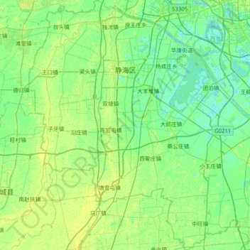
Name: 静海区 topographic map, elevation, terrain.
Location: 静海区, 天津市, 中国 (38.58435 116.70220 39.07181 117.20932)
Average elevation: 16 ft
Minimum elevation: -16 ft
Maximum elevation: 43 ft
Other topographic maps
Click on a map to view its topography, its elevation and its terrain.