
津南区 topographic map
Interactive map
Click on the map to display elevation.
About this map
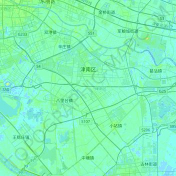
Name: 津南区 topographic map, elevation, terrain.
Location: 津南区, 天津市, 300350, 中国 (38.84900 117.23683 39.07633 117.55396)
Average elevation: 10 ft
Minimum elevation: -10 ft
Maximum elevation: 49 ft
Other topographic maps
Click on a map to view its topography, its elevation and its terrain.