
华亭市 topographic map
Interactive map
Click on the map to display elevation.
About this map
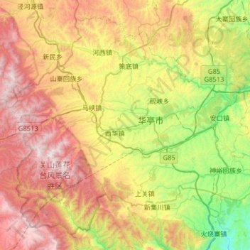
Name: 华亭市 topographic map, elevation, terrain.
Location: 华亭市, 平凉市, 甘肃省, 中国 (35.02229 106.35904 35.39398 106.87891)
Average elevation: 5,781 ft
Minimum elevation: 3,392 ft
Maximum elevation: 9,009 ft
Other topographic maps
Click on a map to view its topography, its elevation and its terrain.