
张掖市 topographic map
Interactive map
Click on the map to display elevation.
About this map
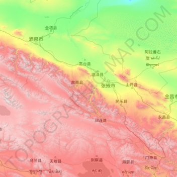
Name: 张掖市 topographic map, elevation, terrain.
Location: 张掖市, 甘肃省, 中国 (37.62649 97.39345 39.88689 102.20450)
Average elevation: 8,724 ft
Minimum elevation: 3,369 ft
Maximum elevation: 18,678 ft
Other topographic maps
Click on a map to view its topography, its elevation and its terrain.