
Ault topographic map
Click on the map to display elevation.
About this map
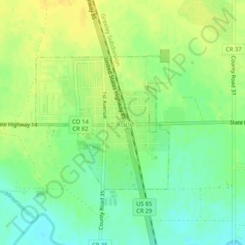
Name: Ault topographic map, elevation, terrain.
Location: Ault, Colorado, United States (40.57529 -104.74460 40.58999 -104.72518)
Average elevation: 4,938 ft
Minimum elevation: 4,895 ft
Maximum elevation: 4,970 ft
Colorado trails, hiking, mountain biking, running and outdoor activities
Other topographic maps
Click on a map to view its topography, its elevation and its terrain.
Air Force Academy
United States > Colorado > El Paso County > Colorado Springs
The campus of the academy covers 18,455 acres (29 sq mi; 75 km2) on the east side of the Rampart Range of the Rocky Mountains, just north of Colorado Springs. Its elevation is normally given as 7,258 feet (2,212 m) above sea level, which is at the cadet area. The academy was designed by Skidmore, Owings and…
Average elevation: 7,080 ft
Lake Pueblo State Park
United States > Colorado > Pueblo County
Lake Pueblo (also known as Pueblo Reservoir) has a maximum depth of 135 feet (41 m) and is impounded by Pueblo Dam. Its surface elevation is 4,826 feet (1,471 meters).
Average elevation: 4,997 ft
Loveland Pass
Loveland Pass is a high mountain pass in north-central Colorado, at an elevation of 11,990 feet (3,655 m) above sea level in the Rocky Mountains of the Western United States.
Average elevation: 11,939 ft
Garden of the Gods
United States > Colorado > El Paso County > Colorado Springs
Average elevation: 6,463 ft
Crested Butte
United States > Colorado > Gunnison County
At the 2020 United States Census, the town had a total area of 535 acres (2.166 km2), all of it land. Crested Butte lies at an elevation of 8,885 feet (2,708 m) above sea level.
Average elevation: 9,180 ft
Fraser
United States > Colorado > Grand County
Fraser is located in southeastern Grand County at 39°56′39″N 105°48′48″W / 39.94417°N 105.81333°W / 39.94417; -105.81333 (39.944158, -105.813355), at an elevation of 8,574 feet (2,613 m) above sea level. It is bordered to the south by the town of Winter Park and to the north by…
Average elevation: 8,845 ft
Vail
United States > Colorado > Eagle County
Vail's average elevation is 8,150 feet (2484 m) above sea level. The town has a total area of 4.5 square miles (12 km2), with no lakes (there is, however, at least one pond). Gore Creek flows from east to west through the center of town.
Average elevation: 9,688 ft
Denver
Denver is in the western United States, in the South Platte River Valley on the western edge of the High Plains just east of the Front Range of the Rocky Mountains. Its downtown district is immediately east of the confluence of Cherry Creek and the South Platte River, about 12 miles (19 kilometres) east of the…
Average elevation: 5,459 ft
Silverton
United States > Colorado > San Juan County
According to the United States Census Bureau, the town has a total area of 0.8 square miles (2.1 km2), all of it land. Silverton is one of the highest towns in the United States, at 9,318 feet (2,840 m) above sea level. The town is located in San Juan County, the highest county in the United States, with a…
Average elevation: 9,813 ft
Wolf Creek Pass
United States > Colorado > Mineral County
The Lobo Overlook, at 11,760 feet elevation on the north side of the pass, provides commanding views of the continental divide.
Average elevation: 11,053 ft
Walden
United States > Colorado > Jackson County
Walden is the Statutory Town that is the county seat, the most populous community, and the only incorporated municipality in Jackson County, Colorado, United States. It is situated in the center of a large open valley called North Park. People from Walden and the surrounding area refer to themselves as "North…
Average elevation: 8,081 ft
Nederland
United States > Colorado > Boulder County
In 1873 the Caribou Mine, at an elevation of roughly 10,000 feet (3,000 m) and 6 miles (10 km) northwest of the town, was sold to the Mining Company Nederland from the Netherlands. The high elevation meant fierce winds and deep winter snow, so the new owners of the mine decided that it was beneficial to bring…
Average elevation: 8,458 ft
Rabbit Ears Pass
United States > Colorado > Grand County
Although lower in elevation than many of the high mountain passes farther to the south in the Colorado Rockies, Rabbit Ears Pass often receives a great deal of snow in winter and is subject to regular short closures during heavy winter storms. The seasonal snowpack on this pass is a major source of water for…
Average elevation: 9,357 ft
Lakewood
United States > Colorado > Jefferson County > Lakewood
Lakewood is located at 39°42′17″N 105°04′53″W / 39.70472°N 105.08139°W / 39.70472; -105.08139 at an elevation of 5,518 feet (1,682 m). Located at the junction of U.S. Route 6 and Colorado State Highway 121 in central Colorado, the city lies immediately west of Denver and 62 miles (100 km)…
Average elevation: 5,633 ft
Rye
United States > Colorado > Pueblo County
Rye has a subtropical highland climate (Köppen Cfb), a climate type usually associated with maritime regions, but is also found in high elevation areas in which summer temperatures are moderated by altitude. Precipitation exceeds that of semi-arid places, and average winter temperatures exceed freezing (O°C,…
Average elevation: 6,857 ft
Douglas Pass
United States > Colorado > Garfield County
Douglas Pass, elevation 8,205 feet (2,501 meters), is a mountain pass in the Book Cliffs of western Colorado. It is located in Garfield County and is traversed by State Highway 139. The pass divides the watersheds of West Douglas Creek to the north and East Salt Creek to the south. It is named for the Northern…
Average elevation: 7,989 ft
Mancos
United States > Colorado > Montezuma County
According to the United States Census Bureau, Mancos has a total area of 0.6 square miles (1.6 km2), all of it recorded as land. The town is located in the Mancos River valley at an elevation of approximately 7,000 feet (2,100 m). The Mancos River was named by Spanish explorers (Rio de los Mancos - "River of…
Average elevation: 7,080 ft
Manitou Springs
United States > Colorado > El Paso County > Manitou Springs
Average elevation: 7,034 ft
Arapahoe County Fairgrounds and Regional Park
United States > Colorado > Arapahoe County > Aurora
Average elevation: 5,850 ft
University of Colorado Boulder (Williams Village)
United States > Colorado > Boulder County > Boulder
Average elevation: 5,361 ft
Fort Garland
United States > Colorado > Costilla County
Fort Garland is located at an elevation of 7,936 ft (2,419 m) in northern Costilla County. Fort Garland is at the crossroads of U.S. Route 160 and Colorado State Highway 159, which leads south towards Taos and Santa Fe, New Mexico. The town of Blanca is 4 miles (6.4 km) west on U.S. Route 160. Walsenburg is 47…
Average elevation: 8,009 ft
Victor
United States > Colorado > Teller County
In 2022, youtubers The Baseball Bat Bros attempted to break the Guinness World Record for Longest home run hit, set by Babe Ruth in 1921 with a verified measurement of 575 feet. The attempt was made at The Gold Bowl baseball and soccer field. Victor, having one of the highest elevations in the United States…
Average elevation: 9,757 ft
Fredrick Law Olmsted, Jr. Park
United States > Colorado > Boulder County > Boulder
Average elevation: 5,459 ft
Manassa
United States > Colorado > Conejos County
Manassa's elevation is 7,683 feet (2,342 m) above sea level. The land within Manassa city limits is entirely flat, with rolling hills nearby. Foothills and mountains (taller than 14,000 feet (4,300 m)) are farther in each direction, including the Sangre de Cristo Range to the east and the San Juan Mountains to…
Average elevation: 7,690 ft
Yampa
United States > Colorado > Routt County
Yampa has a humid continental climate (Köppen climate classification Dfb), with warm summers and long, cold, snowy winters. Due to altitude and dryness, the diurnal temperature variation is large throughout the year, especially in summer, and the growing season is short, typically averaging just 80 days.
Average elevation: 7,946 ft