
山丹县 topographic map
Interactive map
Click on the map to display elevation.
About this map
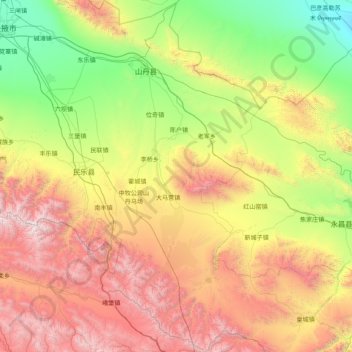
Name: 山丹县 topographic map, elevation, terrain.
Location: 山丹县, 张掖市, 甘肃省, 734100, 中国 (37.79113 100.68699 39.03094 101.60922)
Average elevation: 8,402 ft
Minimum elevation: 4,403 ft
Maximum elevation: 15,988 ft
Other topographic maps
Click on a map to view its topography, its elevation and its terrain.