
Picnic Grove topographic map
Click on the map to display elevation.
About this map
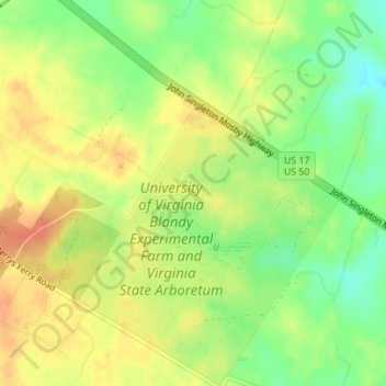
Name: Picnic Grove topographic map, elevation, terrain.
Location: Picnic Grove, Clarke County, Virginia, United States (39.06355 -78.06402 39.06418 -78.06309)
Average elevation: 587 ft
Minimum elevation: 509 ft
Maximum elevation: 650 ft
Virginia trails, hiking, mountain biking, running and outdoor activities
Other topographic maps
Click on a map to view its topography, its elevation and its terrain.
Virginia Beach
United States > Virginia > Virginia Beach
Virginia Beach, Virginia, located in the coastal region of the United States, features a predominantly flat terrain characterized by its proximity to the Atlantic Ocean. The elevation is remarkably low, averaging about 10 feet (3 meters) above sea level, which contributes to the area's susceptibility to…
Average elevation: 7 ft
Great Falls
United States > Virginia > Fairfax County > Great Falls
Great Falls is located at 38°59′53″N 077°17′18″W / 38.99806°N 77.28833°W / 38.99806; -77.28833 (38.9981653, −77.2883157) at an elevation of 344 feet (105 m). Located on Virginia State Route 7 in Northern Virginia, Great Falls is 15 miles (24 km) west-northwest of downtown Washington,…
Average elevation: 289 ft
Bridgewater
United States > Virginia > Rockingham County
According to the United States Census Bureau, the town has a total area of 2.52 sq mi (6.5 km2), nearly all of it being land. Most of the town is located within a bend of the North River. Floods have wrecked the town occasionally. The northern areas are partly shielded from flooding with an Army Corps of…
Average elevation: 1,247 ft
Staunton River State Park
United States > Virginia > Charlotte County > Laconia
Average elevation: 361 ft
Vinton
United States > Virginia > Roanoke County
Vinton has varied topography, considering its 3.2 square mile size. The above-mentioned lake is at an elevation of 890 feet (270 m) above sea level. The Vinton side of the lake consists of a steep, wooded cliff 150 feet (46 m) in vertical height. Vinton's highest point is on Olney Road, at an elevation of…
Average elevation: 1,001 ft
Mattaponi Wildlife Management Area
United States > Virginia > Caroline County
Average elevation: 141 ft
Natural Chimneys Park & Campground
United States > Virginia > Augusta County
Average elevation: 1,381 ft
Wolf Trap National Park for the Performing Arts
United States > Virginia > Fairfax County > Wolf Trap > Shouse Village
Average elevation: 341 ft