
中宁县 topographic map
Interactive map
Click on the map to display elevation.
About this map
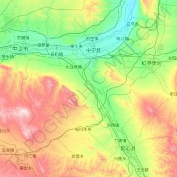
Name: 中宁县 topographic map, elevation, terrain.
Location: 中宁县, 中卫市, 宁夏回族自治区, 中国 (36.82388 105.26944 37.74907 106.06514)
Average elevation: 4,921 ft
Minimum elevation: 3,796 ft
Maximum elevation: 7,713 ft
Other topographic maps
Click on a map to view its topography, its elevation and its terrain.