
隆德县 topographic map
Interactive map
Click on the map to display elevation.
About this map
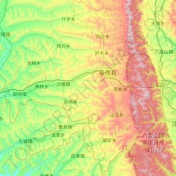
Name: 隆德县 topographic map, elevation, terrain.
Location: 隆德县, 固原市, 宁夏回族自治区, 中国 (35.36277 105.81211 35.78607 106.26114)
Average elevation: 6,831 ft
Minimum elevation: 5,230 ft
Maximum elevation: 9,619 ft
隆德虽地处宁夏南端,但由于平均海拔超过2000米,气温较周围各县偏低,且由于地处六盘山脉北麓,降水偏少,加之水土流失,农业欠发达。历史上更添兵匪之害,是有名的贫瘠苦寒之地。
Other topographic maps
Click on a map to view its topography, its elevation and its terrain.