
贡嘎县 topographic map
Interactive map
Click on the map to display elevation.
About this map
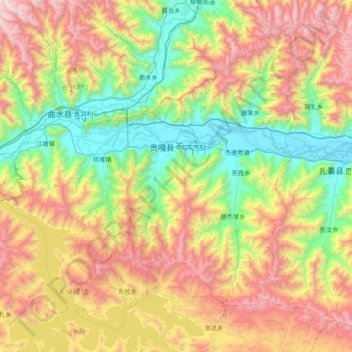
Name: 贡嘎县 topographic map, elevation, terrain.
Location: 贡嘎县, 山南市, 西藏自治区, 中国 (28.93898 90.46995 29.52896 91.23763)
Average elevation: 14,364 ft
Minimum elevation: 11,663 ft
Maximum elevation: 18,858 ft
Other topographic maps
Click on a map to view its topography, its elevation and its terrain.