
仁布县 topographic map
Interactive map
Click on the map to display elevation.
About this map
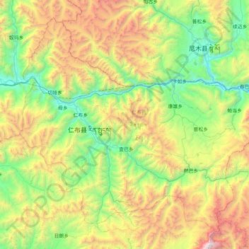
Name: 仁布县 topographic map, elevation, terrain.
Location: 仁布县, 日喀则市, 西藏自治区, 中国 (28.97991 89.64312 29.50743 90.34500)
Average elevation: 15,676 ft
Minimum elevation: 12,060 ft
Maximum elevation: 23,507 ft
Other topographic maps
Click on a map to view its topography, its elevation and its terrain.