
Strandebarm topographic map
Interactive map
Click on the map to display elevation.
About this map
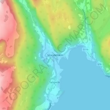
Name: Strandebarm topographic map, elevation, terrain.
Location: Strandebarm, Kvam herad, Vestland, 5630, Norway (60.25089 5.99152 60.29089 6.03152)
Average elevation: 594 ft
Minimum elevation: -3 ft
Maximum elevation: 1,965 ft
Other topographic maps
Click on a map to view its topography, its elevation and its terrain.
Vinjane
Norway > Vestland > Aurlandsvangen
Vinjane, Aurlandsvangen, Aurland, Vestland, 5745, Norway
Average elevation: 758 ft