
瞿昙镇 topographic map
Interactive map
Click on the map to display elevation.
About this map
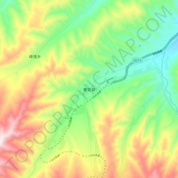
Name: 瞿昙镇 topographic map, elevation, terrain.
Location: 瞿昙镇, 乐都区, 海东市, 青海省, 中国 (36.31316 102.25714 36.39316 102.33714)
Average elevation: 8,520 ft
Minimum elevation: 7,484 ft
Maximum elevation: 9,970 ft
Other topographic maps
Click on a map to view its topography, its elevation and its terrain.