
城北区 topographic map
Interactive map
Click on the map to display elevation.
About this map
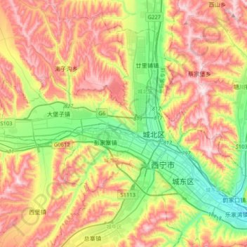
Name: 城北区 topographic map, elevation, terrain.
Location: 城北区, 西宁市, 青海省, 810000, 中国 (36.56130 101.55475 36.75794 101.87436)
Average elevation: 8,133 ft
Minimum elevation: 7,139 ft
Maximum elevation: 9,298 ft
Other topographic maps
Click on a map to view its topography, its elevation and its terrain.