
彭家寨镇 topographic map
Interactive map
Click on the map to display elevation.
About this map
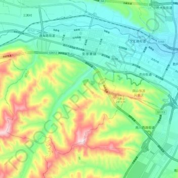
Name: 彭家寨镇 topographic map, elevation, terrain.
Location: 彭家寨镇, 城西区, 西宁市, 青海省, 810000, 中国 (36.58893 101.62351 36.65515 101.73663)
Average elevation: 7,871 ft
Minimum elevation: 7,339 ft
Maximum elevation: 9,042 ft
Other topographic maps
Click on a map to view its topography, its elevation and its terrain.