
巫山镇 topographic map
Interactive map
Click on the map to display elevation.
About this map
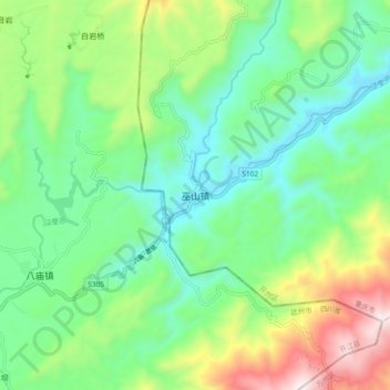
Name: 巫山镇 topographic map, elevation, terrain.
Location: 巫山镇, 开州区, 重庆市, 中国 (30.89725 107.90660 30.97725 107.98660)
Average elevation: 1,699 ft
Minimum elevation: 768 ft
Maximum elevation: 3,806 ft
Other topographic maps
Click on a map to view its topography, its elevation and its terrain.