
四屏镇 topographic map
Interactive map
Click on the map to display elevation.
About this map
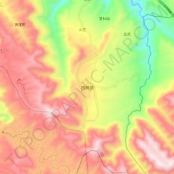
Name: 四屏镇 topographic map, elevation, terrain.
Location: 四屏镇, 江津区, 重庆市, 中国 (28.59208 106.42955 28.67208 106.50955)
Average elevation: 3,606 ft
Minimum elevation: 1,745 ft
Maximum elevation: 5,079 ft
Other topographic maps
Click on a map to view its topography, its elevation and its terrain.