
南彭街道 topographic map
Interactive map
Click on the map to display elevation.
About this map
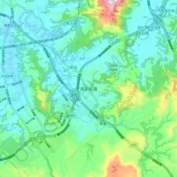
Name: 南彭街道 topographic map, elevation, terrain.
Location: 南彭街道, 巴南区, 重庆市, 中国 (29.30591 106.60977 29.38591 106.68977)
Average elevation: 1,207 ft
Minimum elevation: 876 ft
Maximum elevation: 2,388 ft
Other topographic maps
Click on a map to view its topography, its elevation and its terrain.